To check NWT road conditions, open DriveNWT, the Government of the Northwest Territories’ highway map, before you leave. It shows each highway as open, caution or closed, with advisories and highway cameras. Highway 3 from Yellowknife to Behchokǫ̀ is 104 km, paved the whole way, and takes about 1 hour to 1 hour 15 minutes in good winter conditions.
Where do you check NWT road conditions?
The official source is DriveNWT, run by the GNWT Department of Infrastructure. The GNWT’s DriveNWT page explains the map and links to it (the French version is RoutesTNO). The department’s own winter driving advice says the same thing in one line: check DriveNWT for up-to-date road conditions and weather before you go.
Here is how to read it:
- Road colours. Green means open, yellow or orange means caution, red means closed. Winter roads and ice crossings show their own status on the same map.
- Now, Next 7 Days, Next 30 Days. The first view is what is happening today. The other two show planned work and known closures ahead, which is handy if you are booking a trip later in the month.
- Advisories. Icons for weather, closures, construction, width reductions, fire and smoke, and travel time restrictions.
- Weight restrictions. These apply mostly to winter roads and ice crossings.
- Cameras. The GNWT added a dozen new highway cameras, viewable in the map view. A camera is the quickest way to see whether “caution” means a little blowing snow or a white road.
The DriveNWT page does not list a phone line for road conditions, so plan to check online. Do it before you leave and again before you head home, because conditions change during the day.
What is Highway 3 like between Yellowknife and Behchokǫ̀?
Highway 3, also called the Yellowknife Highway or Great Slave Highway, is the road that connects Yellowknife to the rest of the territory and, through Highway 1, to Alberta. The stretch the Fullstride shuttle drives is the 104 km between the city and Chief Jimmy Bruneau School in Edzo.
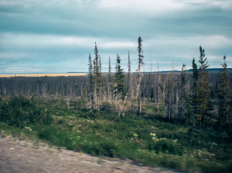
It is a paved two-lane road. The long reconstruction and realignment of the highway was completed in 2006, so the old gravel stretches are gone. The road winds through rock cuts, spruce, lakes and muskeg, with few services between town and Behchokǫ̀, so leave with a full tank.
Things to know for winter:
Short days. In December and early January, much of a morning commute and an afternoon return happen in twilight or dark. Headlights on, always. The GNWT recommends that even in daylight.
Ice fog and blowing snow. On cold, still mornings, fog can sit over open water and low ground, and wind can push snow across the road in open stretches. Both cut visibility fast.
Black ice. The GNWT’s advice is to watch for shiny patches on the road, and to remember that bridges freeze first.
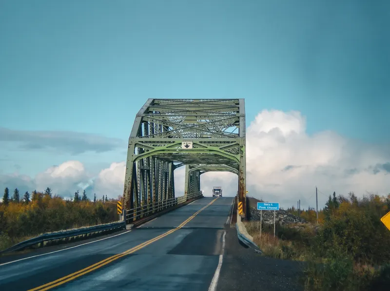
The Frank Channel bridge. At kilometre 243.8, the highway crosses the Frank Channel on the Dehk’è Frank Channel Bridge, built in 1960. The GNWT and the Tłı̨chǫ Government are replacing it: construction started in November 2025, the new bridge is expected to open in fall 2027, and the old one comes out by fall 2028. Traffic keeps moving with traffic control in place. Check DriveNWT for any construction advisory before you go, and expect to slow down here.
Wildlife. Watch for animals on the road at any time of year. If you carry on south past Behchokǫ̀ toward Fort Providence, NWT Parks notes that for about 80 km the land beside the highway is set aside as a wood bison sanctuary, and asks drivers to watch for bison on or beside the road.
What should be in your car for a winter drive in the NWT?
The GNWT’s winter driving page has a full kit list. The short version for the drive to Behchokǫ̀:
- Winter tires, cold-weather washer fluid and a snow brush.
- A shovel, sand or cat litter for traction, a tow rope and booster cables.
- A flashlight with spare batteries, and flares or reflective triangles.
- Extra layers, hats and insulated gloves for everyone in the car, plus blankets or sleeping bags.
- Water in containers that will not freeze solid, non-perishable food, a first-aid kit and any medication you need.
- A two-way radio or satellite phone if you are going beyond the reach of cell service.
And a few habits from the same page. Keep at least half a tank of fuel, which also keeps the fuel line from freezing. Check tire pressure often, because cold drops it. Tell someone your route and when you expect to arrive. Leave early and allow for delays.
When should you not drive?
When DriveNWT shows the road closed, that settles it. The GNWT is direct about closures: “Roads are closed for the safety of the traveling public. Please obey all signs.”
Beyond that it is judgment. Heavy blowing snow, an extreme cold warning, a car that has not been winterized, or a driver who has never done a northern winter drive are all good reasons to wait a few hours or find another way.
Can you get to Behchokǫ̀ without making the drive yourself?
Yes. Fullstride drives Highway 3 to Behchokǫ̀ every school day, all winter.
Weekday shuttle. Fullstride runs from Yellowknife to Chief Jimmy Bruneau School in Edzo, out in the morning and back after school, for $20 one way or $40 return. Riders who travel most school days can use a monthly pass. See the Yellowknife to Behchokǫ̀ shuttle.
Weekend shuttle. From Behchokǫ̀ into Yellowknife, two return trips a day, stopping at the airport, Walmart, a grocery store and downtown, for $120 return. It is starting soon. See the Behchokǫ̀ weekend shuttle.
Charters. A group of up to 14 can charter the van for a trip to Behchokǫ̀, or farther along the highway. Distances to Fort Providence, Hay River and beyond are on the NWT routes page, and group bookings are on the charters page.
If you are heading to Behchokǫ̀ for the first time, our Behchokǫ̀ visitor guide covers what is there and what the name means. For getting around once you are back in the city, see getting around Yellowknife without a car.